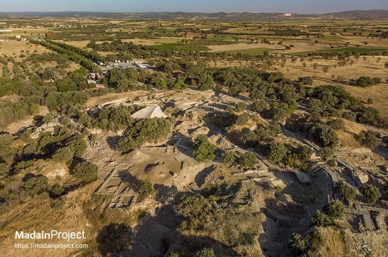
Hisarlık is a tell (archaeological mound) located in northwestern Anatolia, within the Çanakkale Province of modern-day Türkiye. The site consists of successive settlement layers spanning from the Early Bronze Age to the Roman period, and it is most prominently identified with the ancient city of Troy. The mound measures approximately 200 meters in diameter and rises about 30 meters above the surrounding plain.
Strategically situated near the entrance to the Dardanelles (ancient Hellespont), Hisarlık occupies a commanding position overlooking the Scamander (modern Karamenderes) River floodplain and the coastal approaches of the Aegean. Its geographic and strategic characteristics have made it a subject of sustained human occupation and scholarly interest. Excavations since the late 19th century have uncovered a complex stratigraphy comprising at least ten major settlement phases (Troy I– Troy IX), with Troy VI and VIIa being most commonly associated with the Late Bronze Age context of Homeric legend. The site’s visibility in both ancient textual sources and modern archaeological discourse has cemented its status as one of the most intensively studied archaeological tells in the Mediterranean.
circa
Hisarlık was first proposed as the site of Homeric Troy by Charles Maclaren in 1822, but it was Heinrich Schliemann’s excavations beginning in 1870 that brought global attention to the identification. Schliemann, driven by a desire to prove the historicity of the Iliad, believed he had discovered King Priam’s Troy in what is now classified as Troy II. Later researchers, including Wilhelm Dörpfeld and Carl Blegen, reinterpreted the data, proposing Troy VI or VIIa as more appropriate candidates for the city referenced in Late Bronze Age literary traditions. Today, a majority scholarly consensus accepts that Hisarlık was indeed the site referred to as Wilusa in Hittite texts and possibly Ilios/Ilion in Greek epic, though the precise alignment of the Homeric narrative with archaeological layers remains contested.
circa
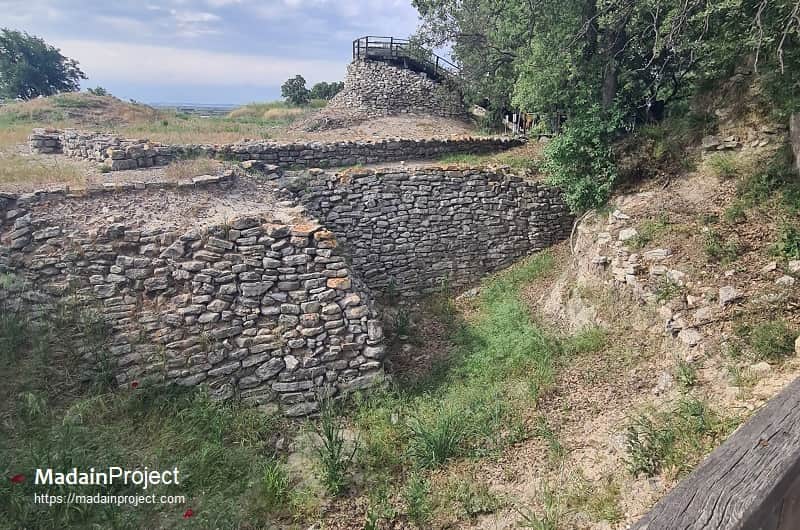
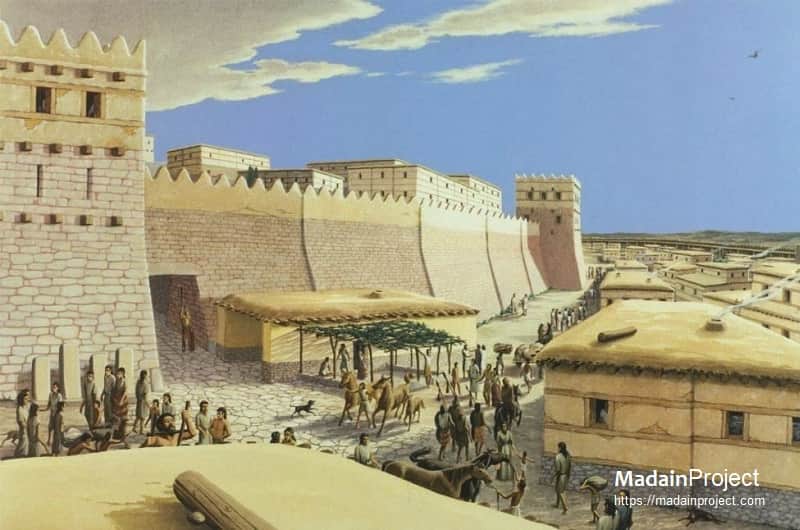
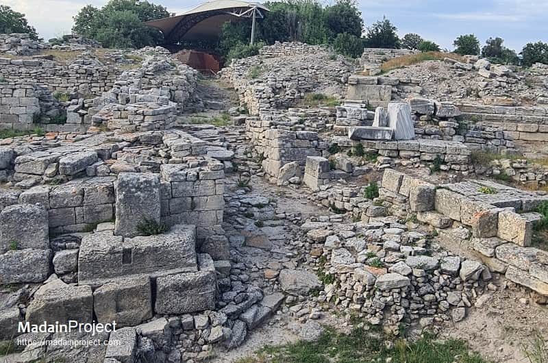
The stratigraphy of Hisarlık, Turkish word for "place with a fortress" (from hisar, fortress), archaeological site reveals a multi-period occupation beginning in the Early Bronze Age (Troy I, circa 3000 BCE) and continuing into the Byzantine era. Each level displays distinct architectural styles, fortification strategies, and domestic arrangements. The citadel walls of Troy VI, constructed with ashlar masonry and projecting bastions, represent a pinnacle of Bronze Age urbanism in the Troad region. The subsequent destruction layers of Troy VIIa, dating to circa 1180 BCE, have been associated with either natural disaster or conflict, potentially correlating with the so-called Trojan War. Excavations have revealed megaron-style structures, storage jars, and imported Mycenaean ceramics. Since the 1980s, systematic work led by scholars such as Manfred Korfmann and later Ernst Pernicka has emphasized the lower city’s expansion and the site's role as a regional power center with far-reaching trade networks. The surrounding plain, including roads, cemeteries, and outlying settlements, continues to be surveyed as part of broader investigations into the landscape of Bronze Age Troy.
Signup for our monthly newsletter / online magazine.
No spam, we promise.
The Madain Project is an online archive of Abrahamic History and Archaeology.
Abrahamic History & Archaeology is the study of history and archaeology with respect to the three Abrahamic Faiths without considering the religious and theological aspects. The goal of Abrahamic History is to understand how and why the religious doctrines and behaviours have evlovled and changed over time. Searching for patterns in the evolution of significant cultural events such as the development of farming, the emergence of cities, or the collapse of major civilizations for clues of why and how these have influenced the three major Abrahamic religions.
Cloud Drive -
About -
Help -
Privacy Policy -
Contact
Madain Project: Encyclopedia of Abrahamic History & Archaeology.
Copyright MadainProject 2017 - 2026.
![]()
![]()
![]()
![]()
![]()
![]()